

The Ordnance Survey, the national mapping agency of the United Kingdom, was created to provide the first detailed maps of the nation, to assist with military planning.
A triangulation survey commissioned by King George III and the Royal Survey between 1784 and 1790 laid the basis for what would later become the Ordnance Survey. This was motivated by a desire for accurate maps, in advance of a feared French invasion.
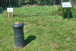
In the summer of 1784, Major General William Roy created a 5-mile baseline, using glass rods (to prevent expansion and contraction caused by the weather) on Hounslow Heath. The terminals at each end are marked by an upturned cannon of the period.
At the southeastern end, there are also 2 plaques, one commemorating the 200th anniversary of Roy's birth, the other giving information about the memorial.
Roy had already completed a military survey of Scotland between 1747 and 1755. The baseline laid the foundation of the trigonometrical survey of Great Britain between 1791 and 1853, which was later renamed the Ordnance Survey.
0 comments:
Post a Comment